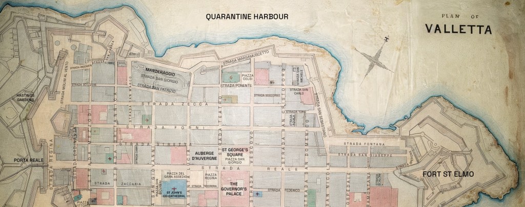
If you walked through Valletta in 1880, you’d recognise much of the city as it is today. But one striking difference is that the street names were all in Italian—a reminder of Malta’s past before British influence became dominant.
In my research for my historical murder mystery series set in 19th-century Valletta, I came across this fantastic hand-drawn map from 1884. The map is based on the Malta Water Supply Plan for Valletta by Sir Osbert Chadwick, and offers a fascinating glimpse of the city just a few years after the period in which my books are set.
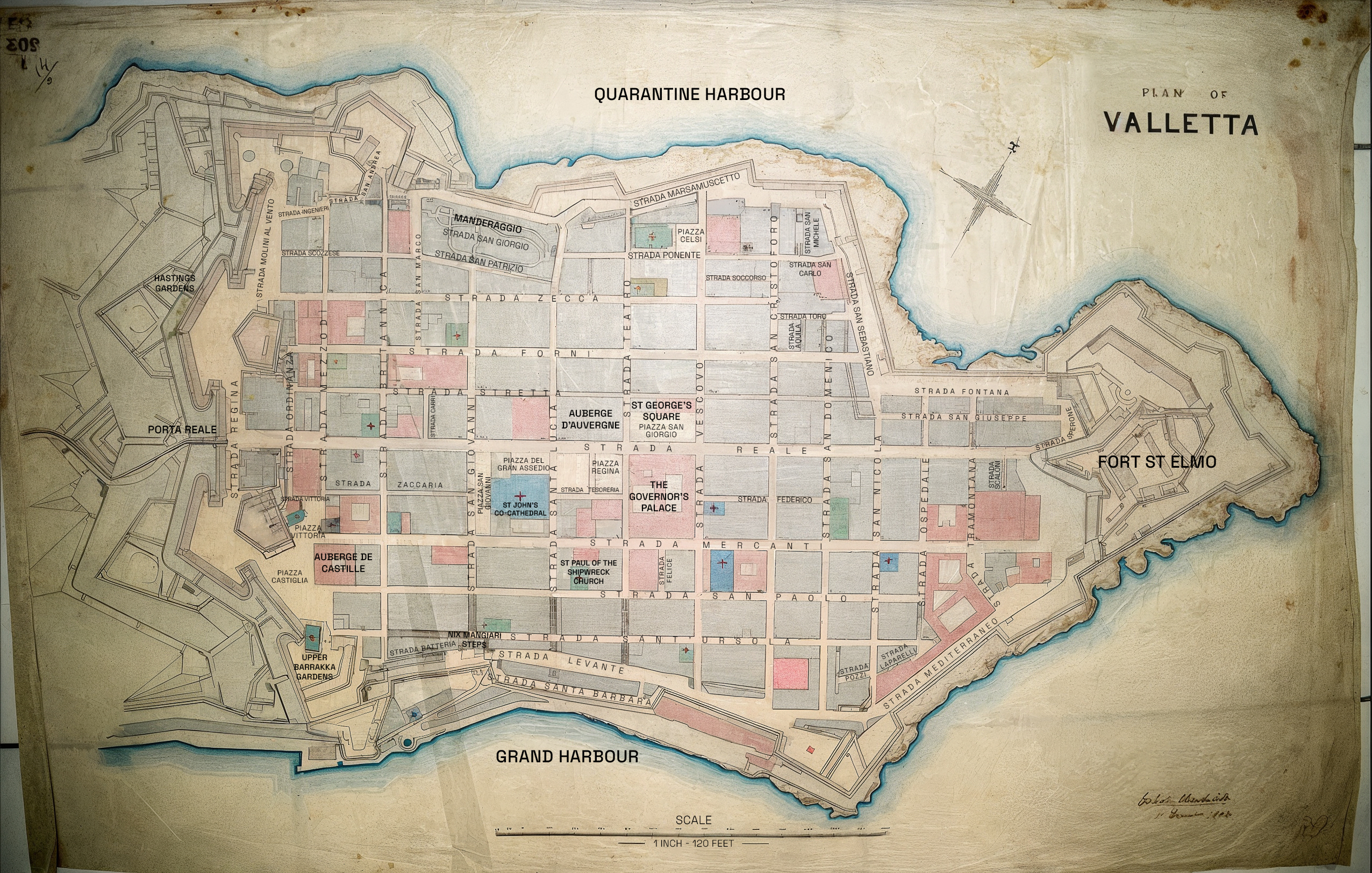
Click the map to view full size and explore the street names.
I’ve taken the liberty of adding some of the locations that feature in the novels, so you can get a sense of the geography of Valletta in the 1880s. I’ve mostly used the original Italian street names, occasionally including the English equivalents.
For example, Strada Ponente is where Sam McQueen’s lodgings are, while other marked locations correspond to key scenes from across the series, such as Upper Barrakka Gardens.
If you’re interested in exploring further, you can also view an interactive map of Valletta with locations from the books plotted onto the modern city – click here.
Have fun comparing this historic Valletta map with the city as it is today—and seeing how the past and present overlap.
Map is based on the Malta Water Supply Plan for Valletta (1884) by Sir Osbert Chadwick. Original held in the Water Services Corporation Archives, Malta. Modern annotations by the author.

Leave a comment